


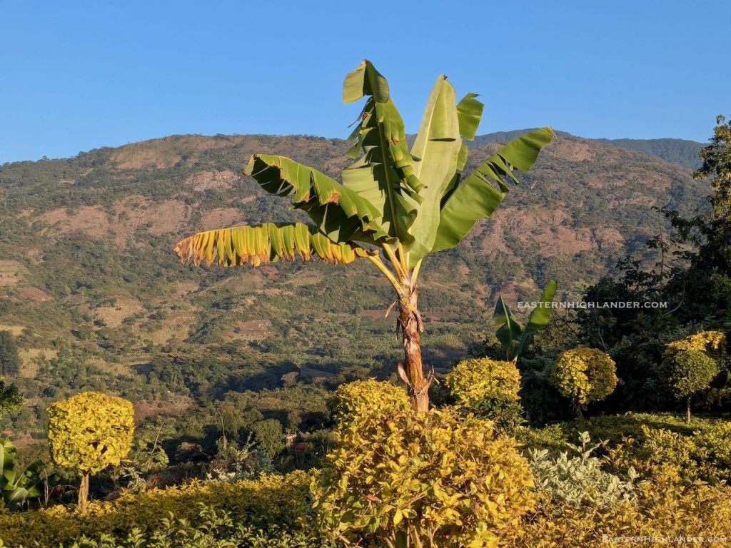
Second time seeing one up here at 2200m, Troutbeck, Zimbabwe.
August 2025.
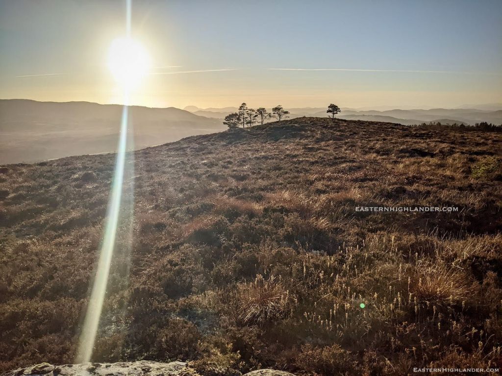
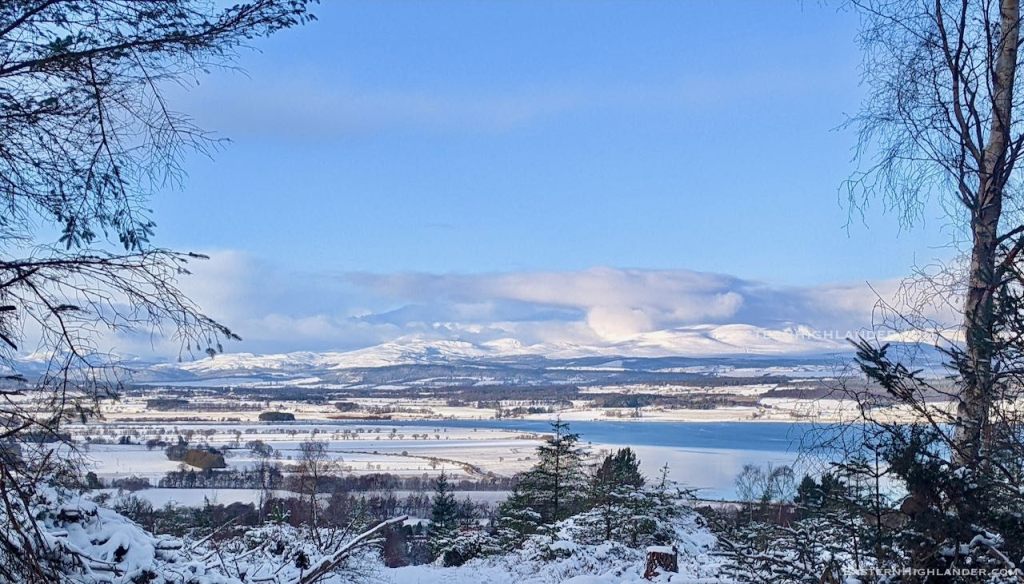
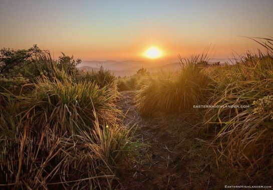
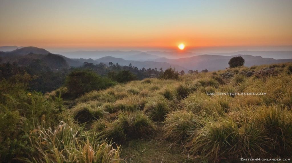
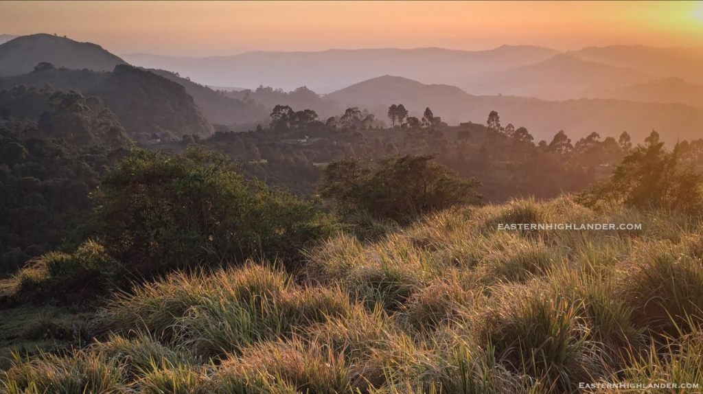
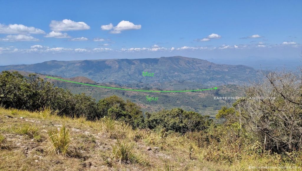
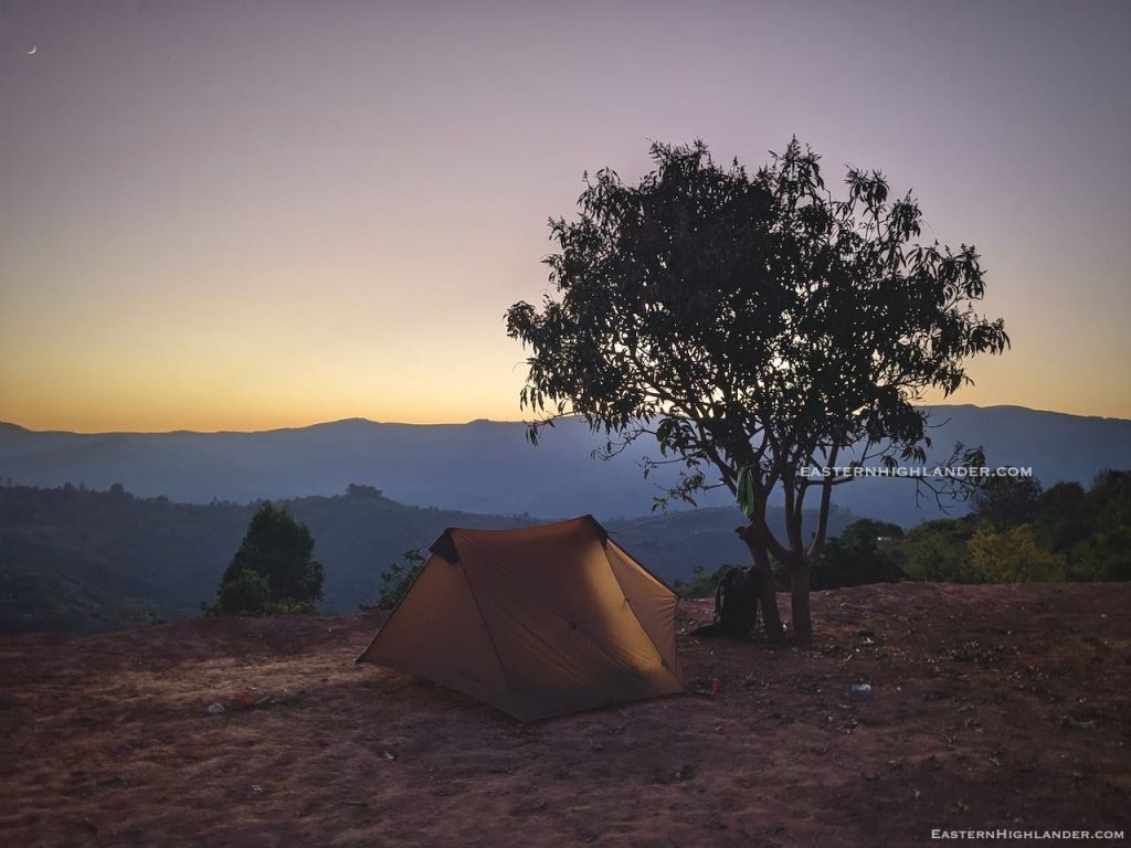
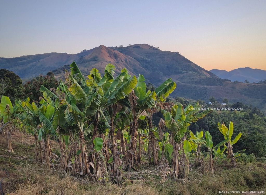
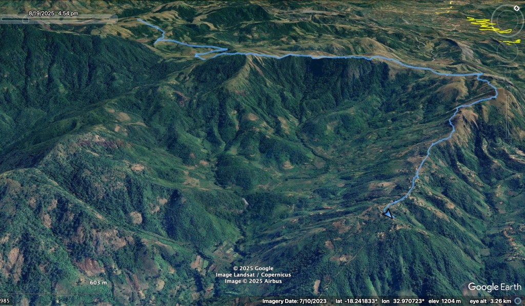
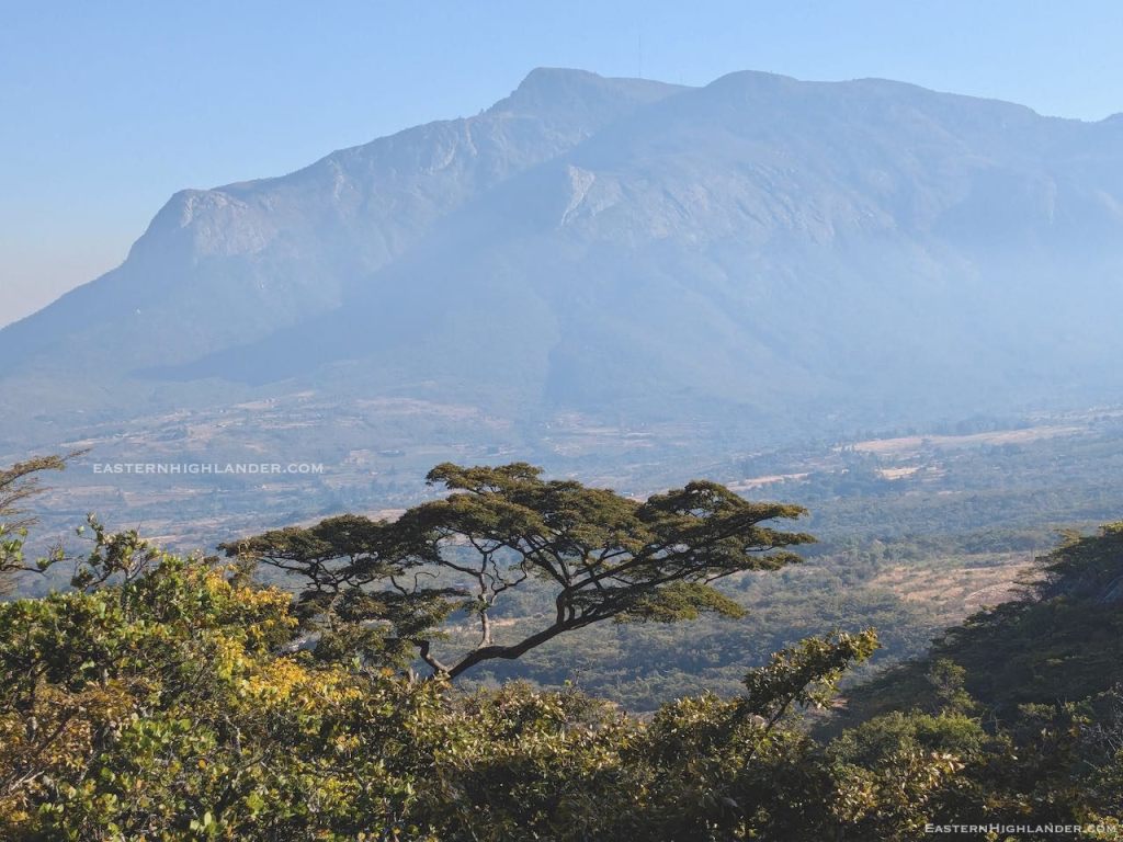
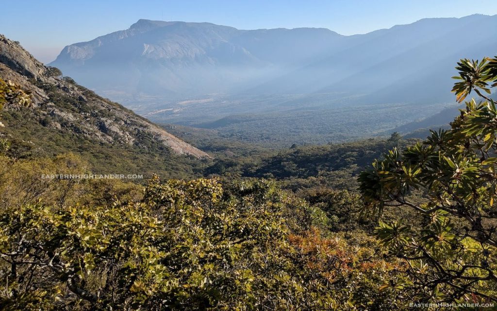
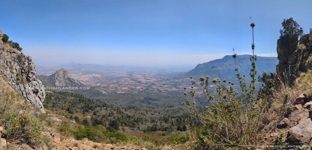
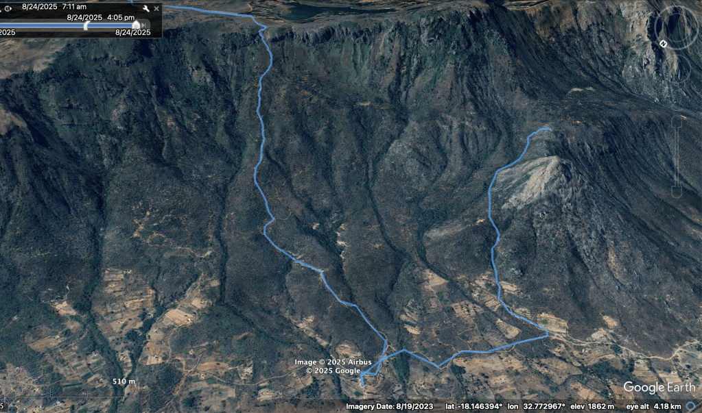
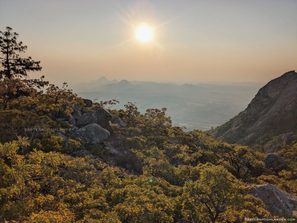
Well, walking from Troutbeck to Honde has been on my bucket list for quite some time – more so since I ‘discovered’ the high pass last year, 4km further south of Nyafaru – and this trip does not disappoint – just look at the sunrise on Day 2:
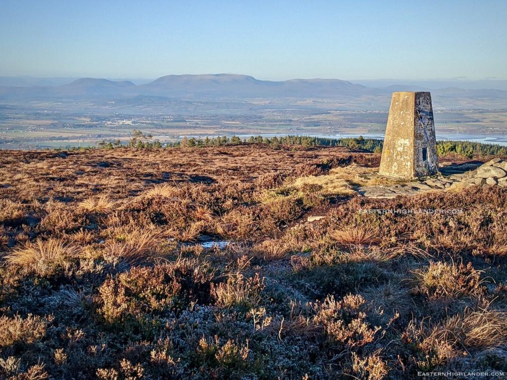
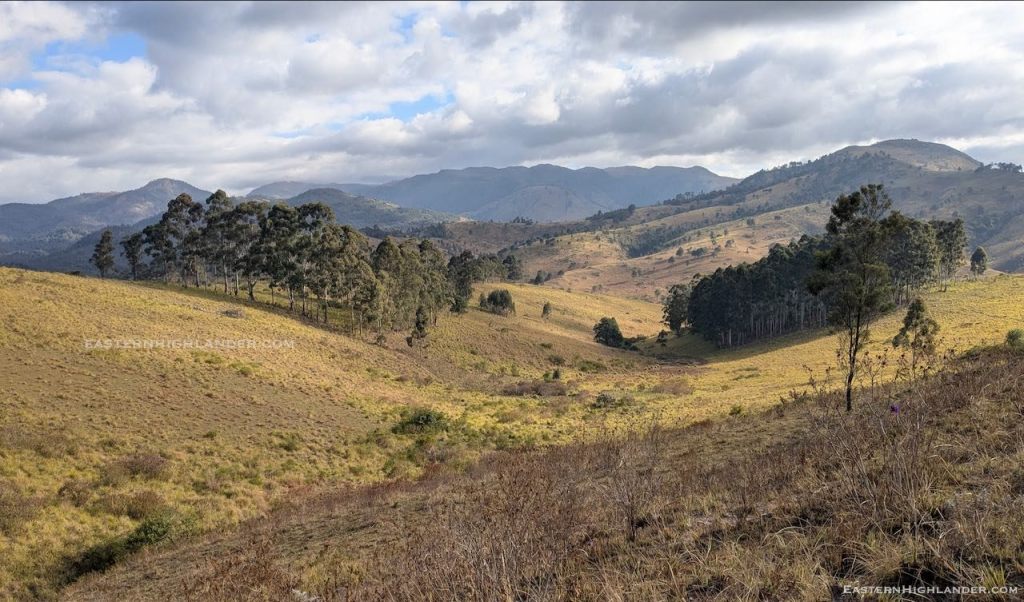
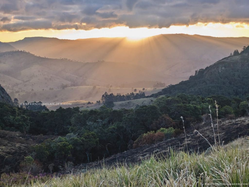
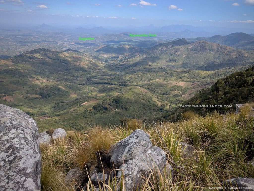
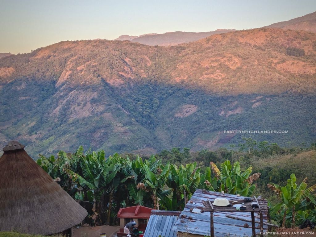
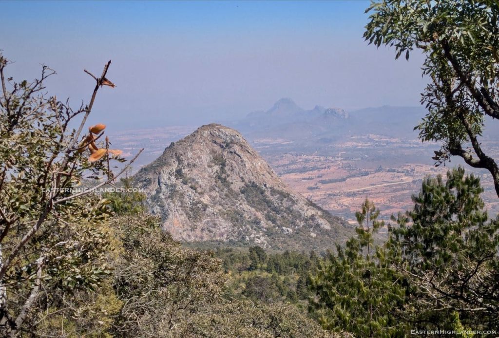
And later in the day, looking down into Honde:
Day 1
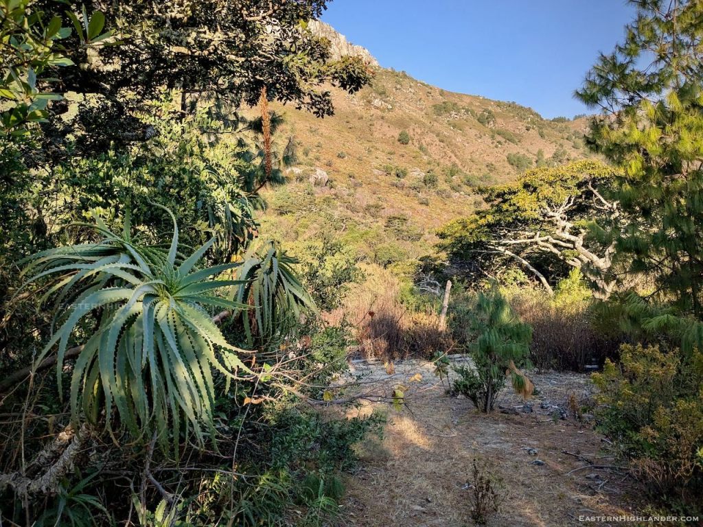
The walk in was my now usual – and not so scenic in winter – trip from Troutbeck through the woods and over the hill, dropping down to the extended Dazi area, across the Menzi and then shoes-off-crocs-on across the Gairezi at John’s Shack.
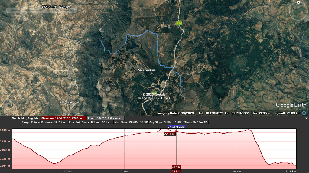
I left home at 9:30am intending an easy-ish, not-overdoing-it, first day and a low camp, but the inevitable just happened and the distance-eating, stretch-goal was to get up onto the ridge so that I could wake up to views of Honde valley. I ended up clocking 20km with my 17kg pack on day 1.


Day 2
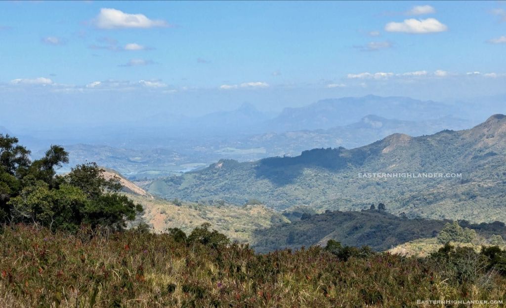
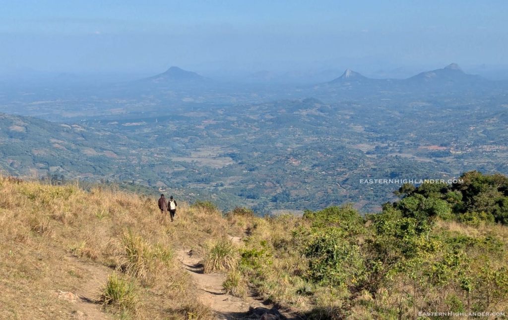
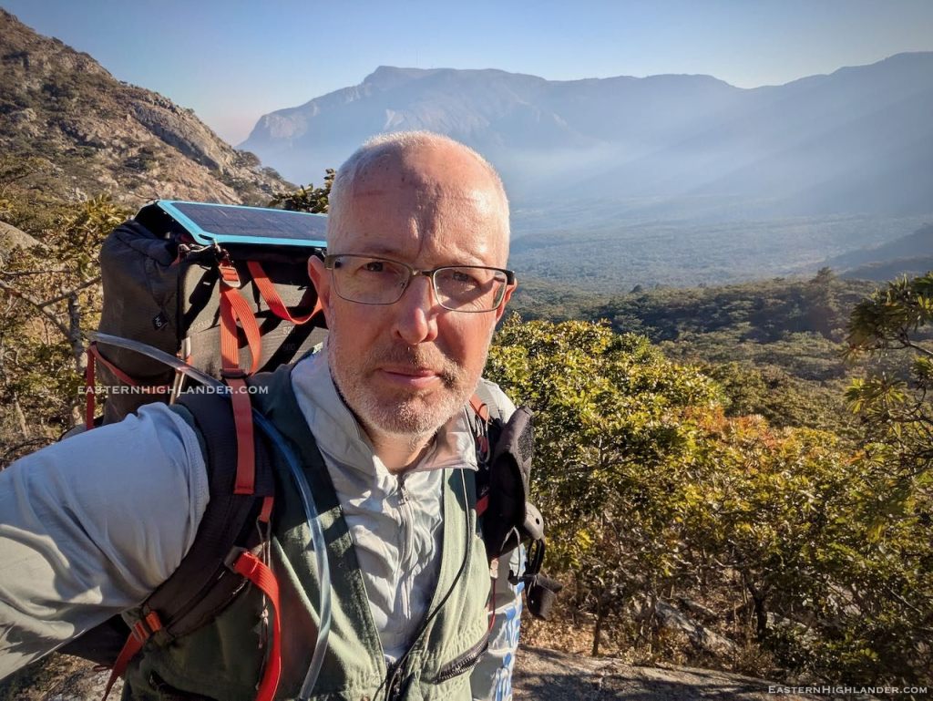
Just look at the sun rise over Mozambique! Totally worth the effort yesterday. Good job I was up early because at 6:30am a work crew passed me on their way to clear a fireguard.


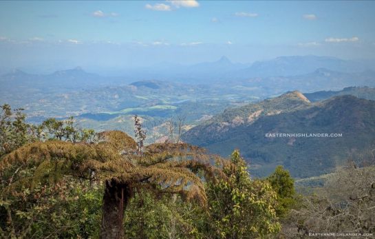
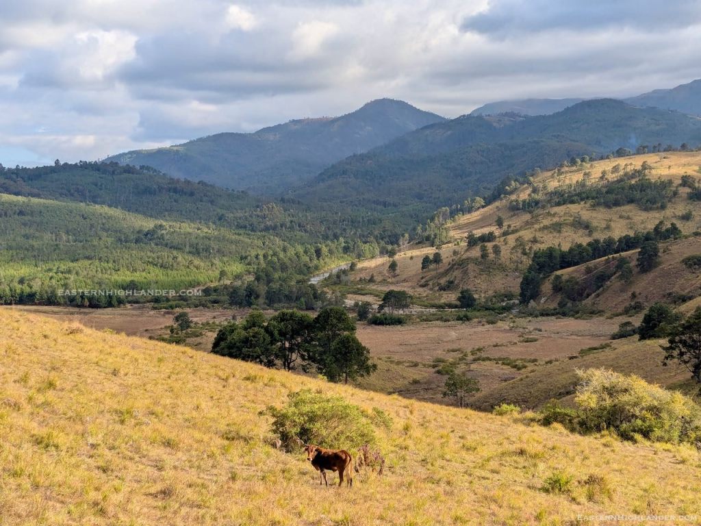
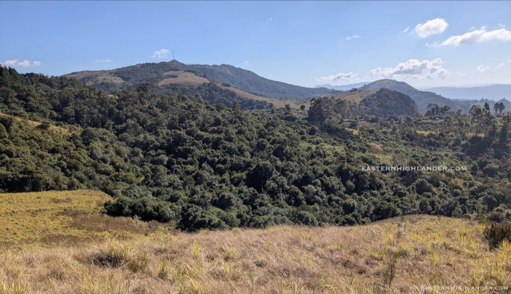
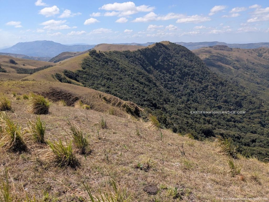
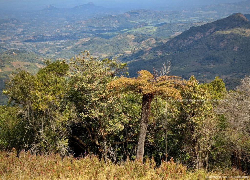
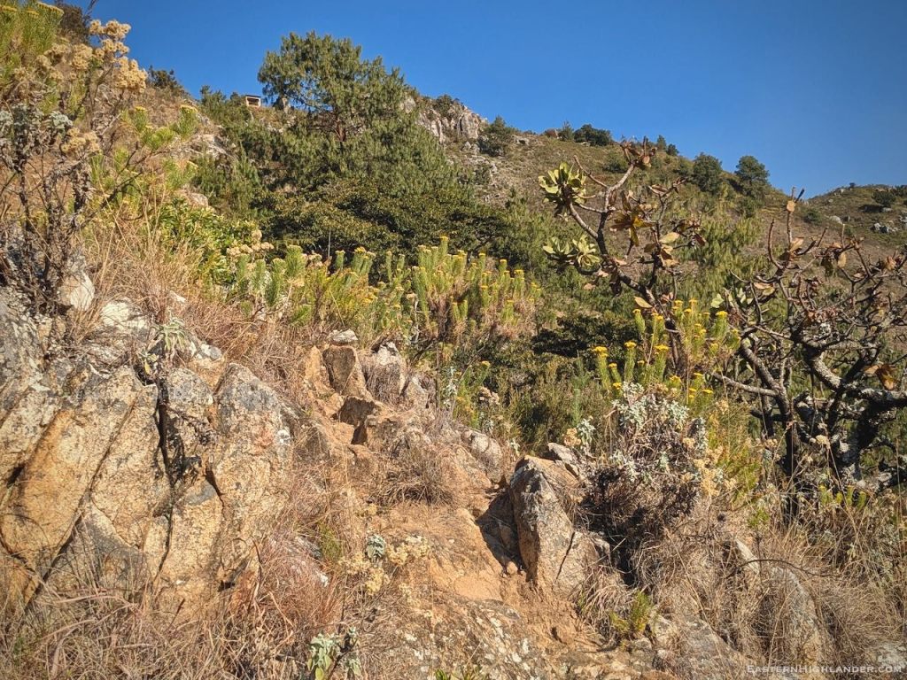
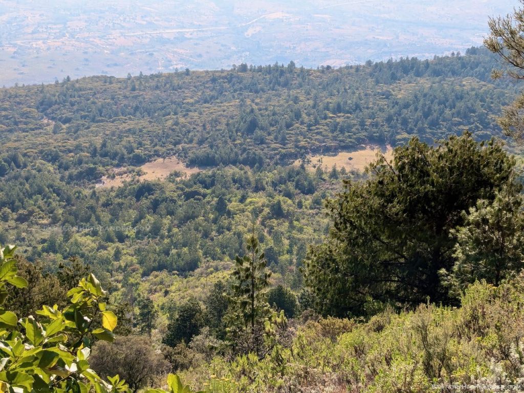
Down in the general direction I thought I needed to be going. I tried a spur as an interesting shortcut but that ended steeply and I retraced before dropping further, going through a couple of small farms. Tramped on and almost double backed south to get to a low river crossing with log bridge and a food stop to dry the tent. Thereafter all uphill to get onto the ‘ridge’ peeling off from the more direct path down to Sagambe and Aberfoyle. Tough going after the 20km yesterday but the views were going to make it worthwhile I was sure. Gum to start with then Msasa. The way cleared on top to long grass to the north with rolling hills and the Afromontane type forest dropping very steeply to the south – see pics with tree fern.
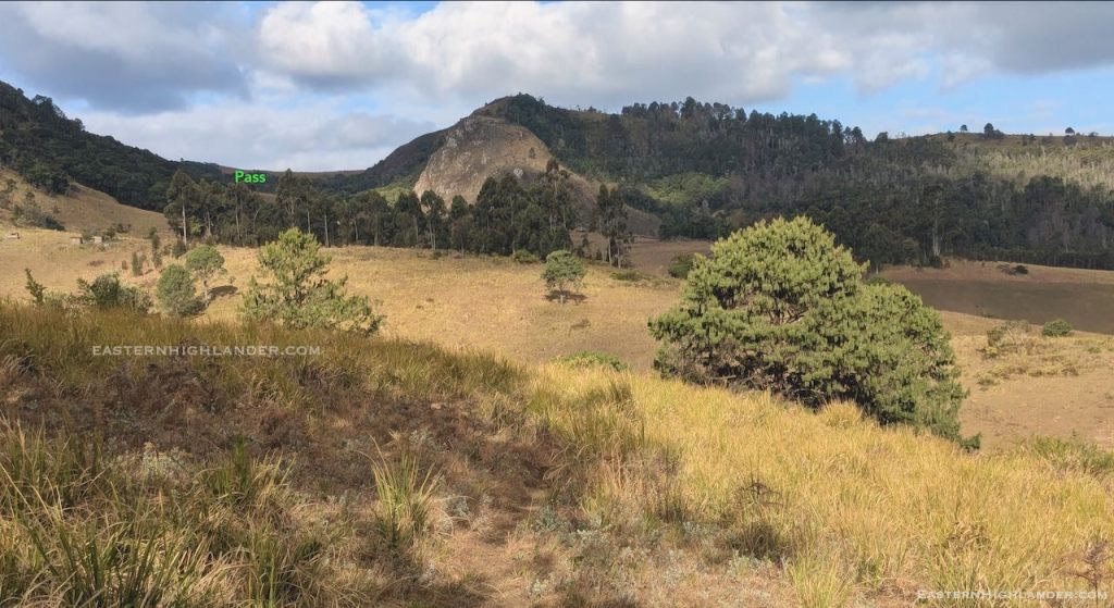
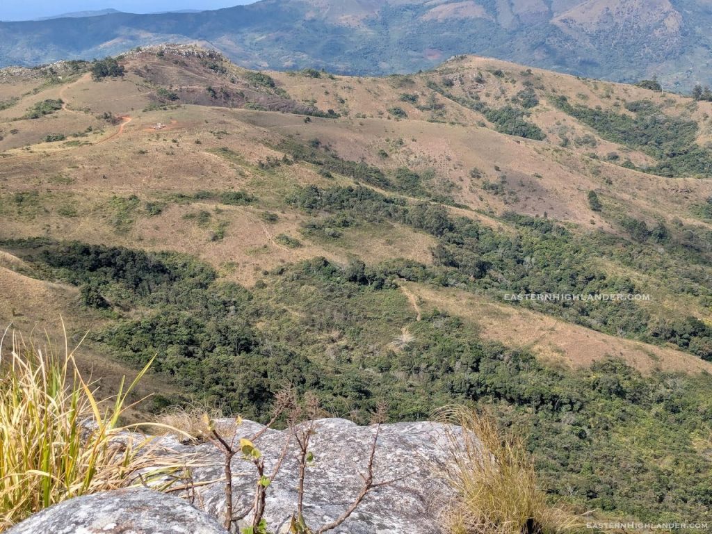
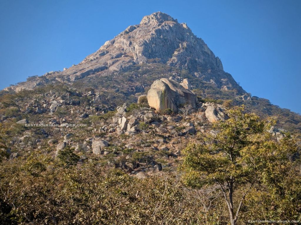
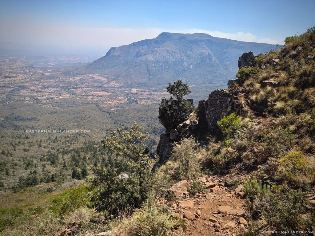
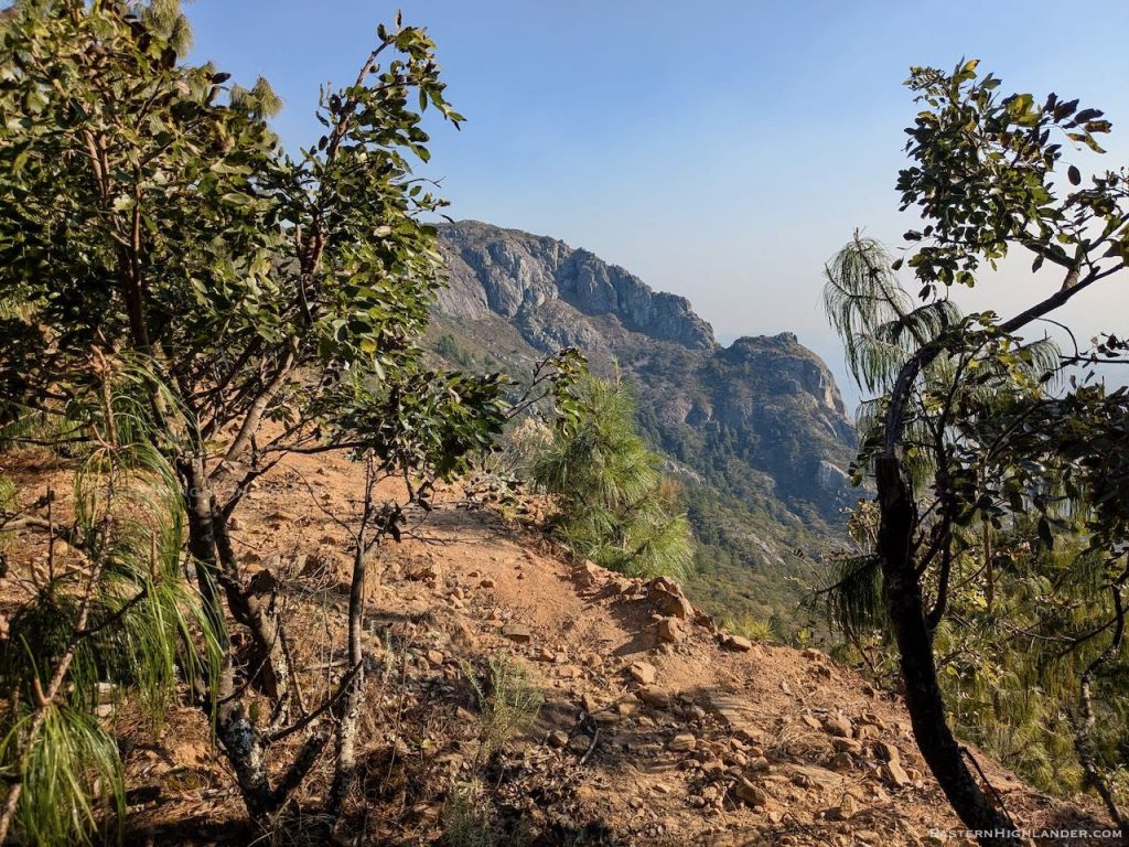
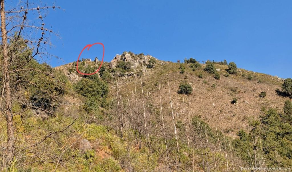
Reasonable path on the ridge though it circumvents most tops and you have to make a special effort to go up them for the views south into Honde. The last top is rocky and has the best views of the onward journey on the downward spur and across to Mozambique. Later, looking back this top appears to have a vertical face on the south side.
Descending, I decided not to try for Magadzire or another set of hills I had in mind – the 20 km had worn me out – so I passed some houses and found a shop, on its own, seemingly in the middle of nowhere. Thinking more, I decided it was located at the top of the climb up from the valley floor, and, low and behold, a donkey train passed by before I could snap it. You will now find Chazanawako shop on Google maps though not yet on Google search (28 Aug 2025).
The shop owner also had donkeys and collects the dung, selling it for $1.50 for one of those giant sacks – about three times the size of a normal sack, or he uses it for his own banana plants further down. Anyway, this was a useful refreshment stop on a weary day and my last rest in the hills before heading down the spur towards Sagambe.
15:30pm. It wasn’t long before two lads passed me, introducing themselves as Trevor and Kudzi from Troutbeck Hotel – they were on their way home having left Troutbeck that same morning! Hmmm. Younger, fitter and not carrying anything. Their route was Nyafaru, Magadzire and various shortcuts they said.
Further down the path widened and became the route for people walking to their small holdings on either side of the spur. I could see a truck loading green bananas. At this point someone spotted me but I was not to know until I got home!
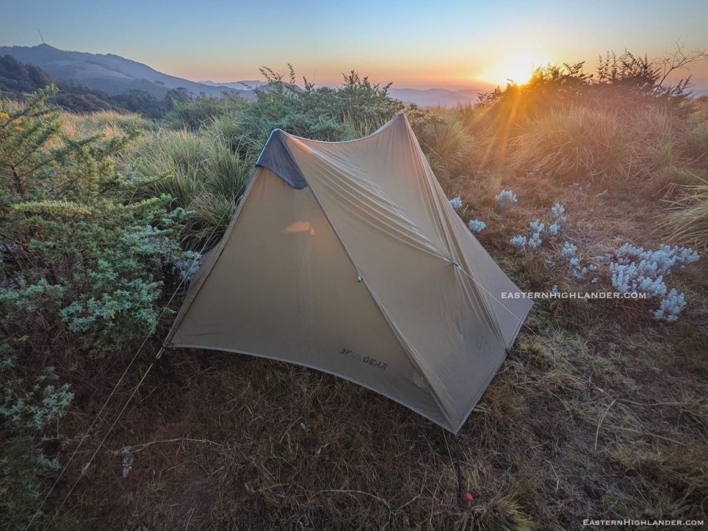
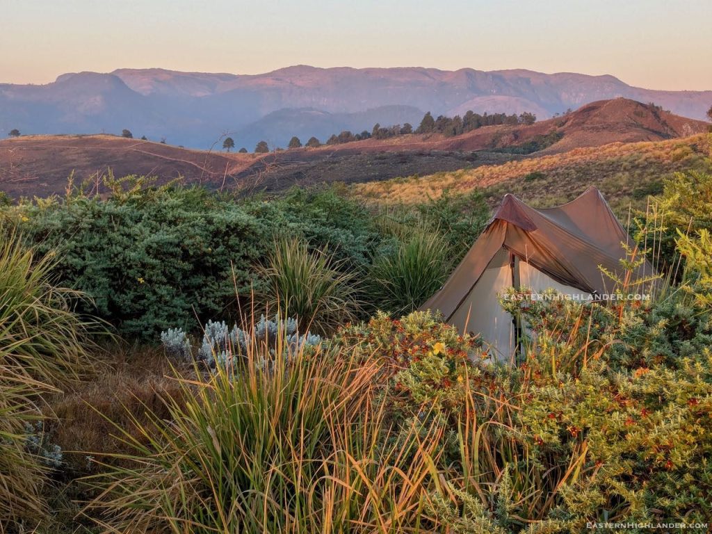
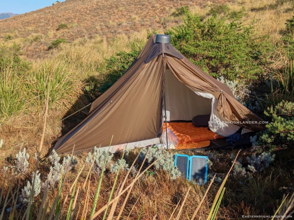
Around 5pm I called it quits and got permission to use a recently cleared house site for my tent – see pics. I had about ten helpers to put up the tent and bang the stakes into the hardened surface. Photos all round. Bath, as it was ‘town’ the next day! I was warned to be up early to be guided down as the bus was to leave Sagambe at 8 am.


Day 3
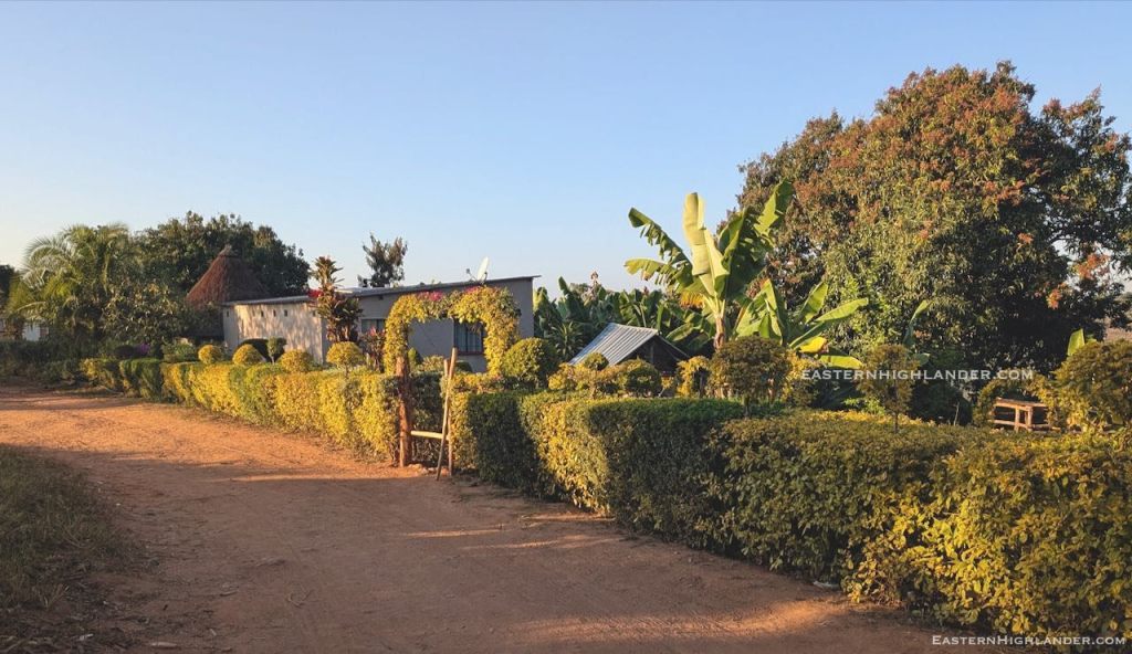
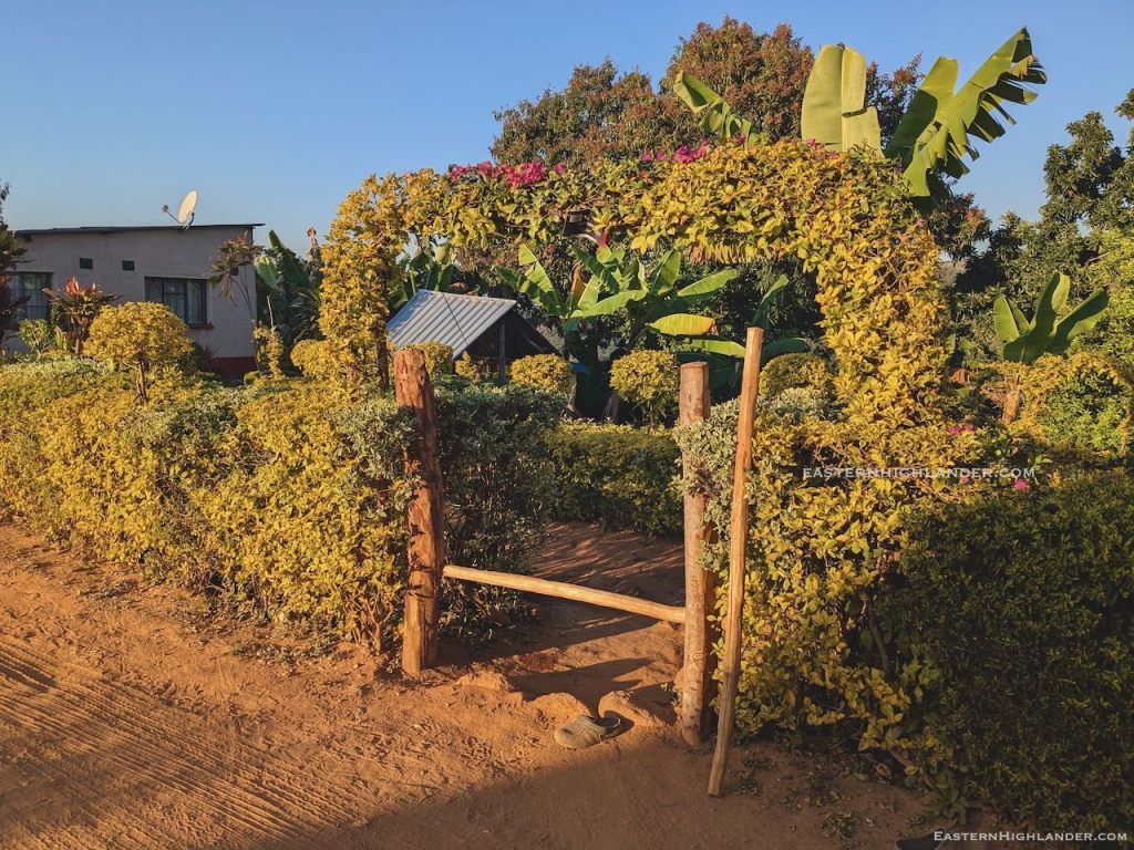
At 4:30 am I was having my porridge, packing up and taking pics. The real sunrise was the other side of the Mozambique mountains so nothing like the morning before. Around 6 am I was taken to another house to meet the rest of the family, then headed on down – see pic of the topiary on the way. Was going too fast for proper picture stops as I couldn’t miss this early bus. Ended up eating 7 km in record time.


The bus takes 4 hours from Sagambe to Selborne with an infinite number of stops on the way for more, and more, and more and more to get on. Best experience it yourself! At Selborne I was whisked into a shikashika, with only two other passengers, at that point, for Nyanga. There was more drama on the way but that’s for another day.
Great trip – with plenty of scope for more!

And if you though having a kid on your knee for an hour would spare you from the crush … you would be mistaken!
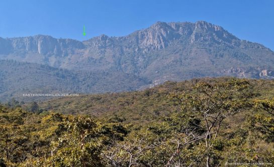
Up early, pack, and a scenic walk through the trees and down from the camp site to the first houses at 1640 m. Great views west and then south to the imposing remote peak.


Toyed with walking another 3 km to Sedze proper, for refreshments, but that would have meant an extra 6 km return to where I was. Hence onwards and upwards though the small holdings. Heard a chigayo and stopped in for cup of water but didn’t ask to fill up all the tanks which I should have done – there was nothing doing higher up which I was banking on before the big push. 5 litres is 5 kg, or even more, going up hill! So I ended up rationing the whole climb up …
OK, this route is a tough straight up and down path – no gentle zigzagging today – just one big slog to the top (2280 metres) with my 12 kg load. Not that much fun, but there was the ‘excitement’ of not knowing how tough it would be at the top.
Well I can now tell you that it is very steep, even with some novel zig zagging for the crucial last ±30 metres of ascent, and the path is full of loose stones/rocks meaning uphill is doable with some scrambling but I’d say going down hill would be a worry about sliding, and there isn’t any margin for error!
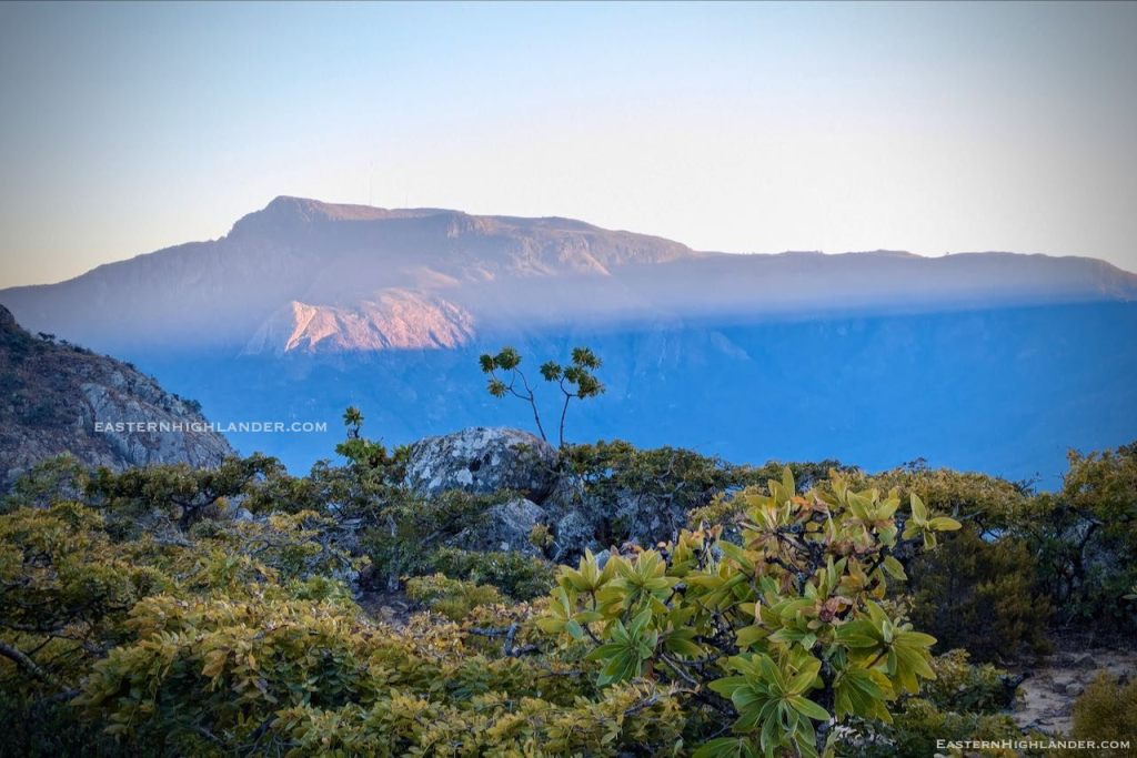
Views are striking!


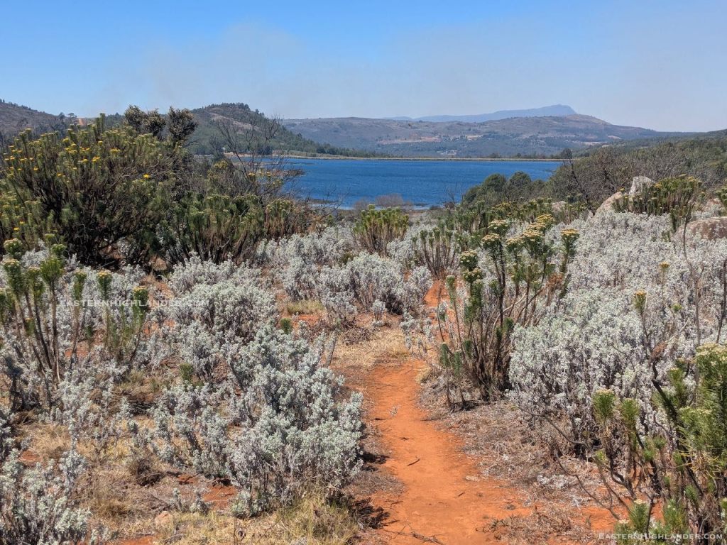
Of course it is ‘as flat as a pancake’ on top, with a lake; it’s not called an escarpment for nothing .

Luckily I was short on water and tramped on another 2 km or so, all the way to the official World’s View site (2275m) to fill up my 3 + 2 litres of water capacity. The Mudhara in charge told me about his own route down and assured me it was less steep than my intended route (which I climbed up the next day as ‘Route 2’).

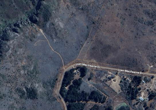
His route was not yet visible on Google Maps – which only has data from 2023 (now looking, and knowing it is there, you can see signs of it though!). I had been intending to descend using the path showing on Google starting from from the northern corner of Joan Macilwaine Drive:

Shortening my trekking poles I started off down the narrow zigzag path, hoping I was doing the right thing.
The path was at least consistently used and I could keep using one pole and one hand to stay upright. Panganai passed me also going down on his way back to Mangondoza and assured me all was fine.
There is the odd patch of exposure but nothing extreme and the path slowly winds its way down to the open pasture areas at 1980 metres.


The way to Sedze Primary continues on down but I was more interested in exploring at this level to see how far I could traverse northwards round towards the other route.
At the north end of the pasture there were areas of dried up bog and a stream still running for fresh water. Plenty of logging paths and sawing patches at that end and I decided to follow my nose, leaving behind a perfectly good potential campsite on flat grass, and with running water!

I made a reasonable path following someone’s croc pattern made in the last day or so, but evening was drawing in and I eventually found the last open flat spot in the hard dust prior to any major descending.
Now the thin wire pegs were useful – usually, higher up, they are lost in the softer ground and long grass and I take more of the old school large plastic jobs.


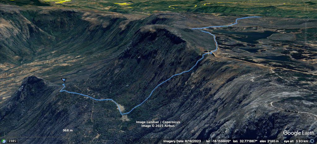
And from Google Earth:

It’s slightly trickier than you think it should be! Here goes:
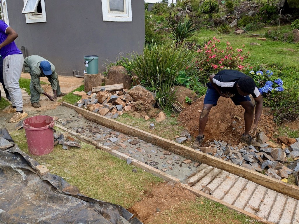
The starting point is the wooden ‘form’ (‘foroma’ locally). Easier to show than explain: Mr Tongai has his foot in one segment of one form, below
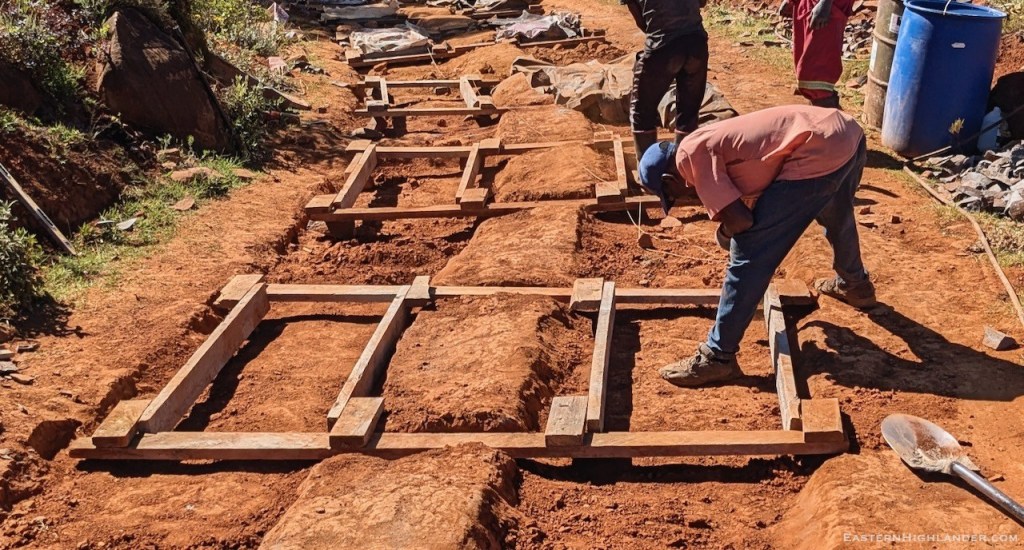
Two parallel segments each 60 cm wide and 150 cm long – wood on its short side. Held together by two pieces on the flat so that people can drive down the middle and on one side with out too much disturbance (easier said than done). Not that tightly nailed to give flexibility and to allow deconstruction of a side when needed. 90 cm internal spacing: inside to inside of the two segments.
We started out on a less steep hill to get our hand in.
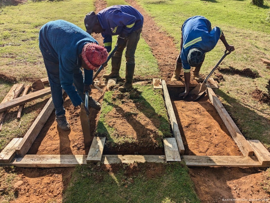
There are so many ‘degrees of freedom’ that it’s best not to think about them too much, just get stuck in and your common sense will do the rest, with a line, steel pegs (+hammer), and spirit level.

The process
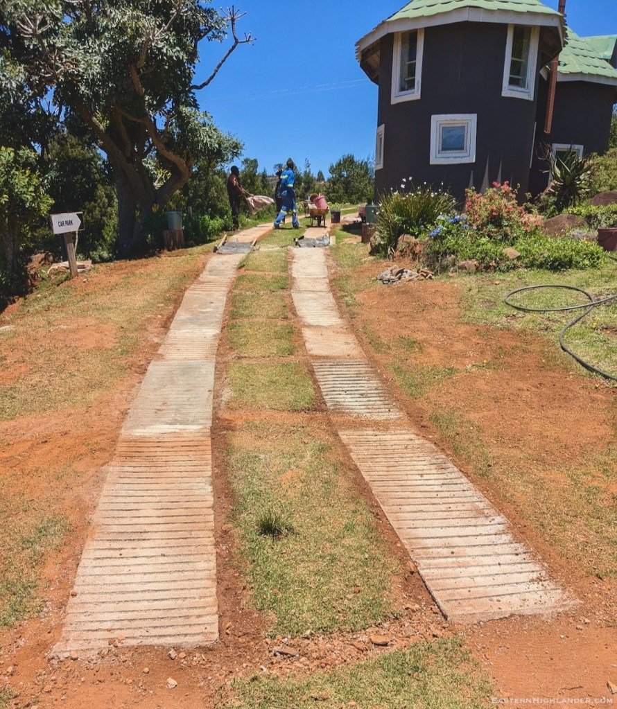
Each segment is 1.5 m long and we make two parallel segments at a time using one of our wooden ‘forms’. Then we jump 1.5 m, leaving a gap, and put another form down and make the next pair of 1.5 m segments.
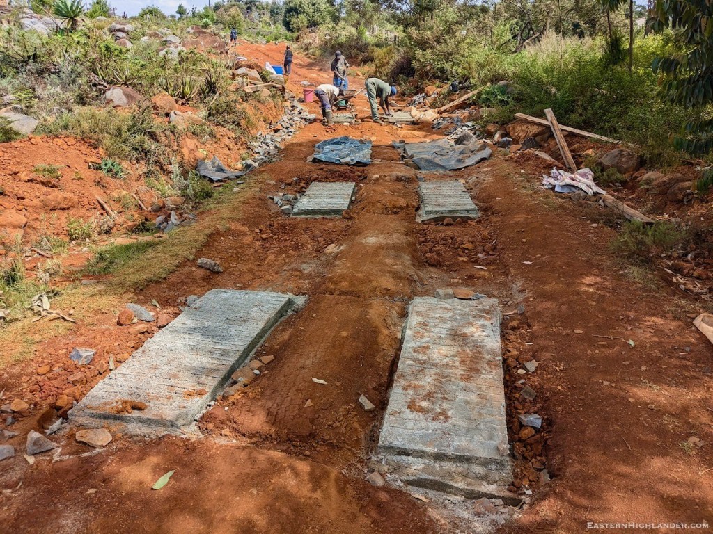
In Maths sense: we make segments 1, 3, 5, 7 then go back and make 2, 4, 6, etc. The even numbers e.g. 2 are just joining two odd numbers, before and after e.g. 1 and 3, so they are quite a bit easier because all the angles and gradient are already set by the existing segments, the odd numbers.
Where the trouble begins
Positioning the initial, odd numbered, segments, going up hill, is a bit of an exercise. Variables to be considered include the following:
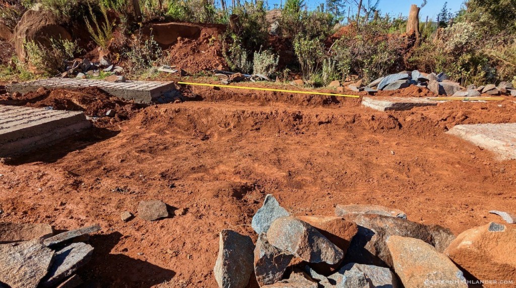
Depth: down to – pfungawe/ solid foundation for the concrete. May have to go deeper on one side which upsets things a bit from a side to side perspective and your form does not account for this.

Height: thick enough to be solid, I’d say we were not less than 15/20 cm thickness.

Alignment: a) with the direction of the road, and b) crucially, because we are jumping ahead with gaps, that the eventual alignment of all the joined up sections creates a smooth, fluid curve (of short 1.5m straight segments).
The Form is not perfect: the form may well be bent / not perfect so the form itself may create ‘challenges’ by creating a higher apparent level for the concrete on one side. See next section.

Overfilling one of the segments: because we use a wooden ‘form’ there is a huge, undeniable, magnetic force on who ever is filling the concrete and stones to fill in the form to the top of the parallel planks, whereas the string/line (that should be in place) going from existing form to existing form says otherwise. I.e. the level of the concrete may need to be lower than the side planks of the form.
Is an individual segment on a uniform slope/gradient/plane: we haven’t really bothered about this as it ‘just seems to be alright’ as the form is only 1.5 m long.
Is each single segment level: is an individual segment level, left to right – mostly we have not been so far.
Anchor
Each segment has a 25 cm deep hole close to its lower end to anchor it in the ground and prevent any down hill movement (reaction) caused by the (action) driving wheels of a heavy truck of sand.
Onwards and upwards: the main event
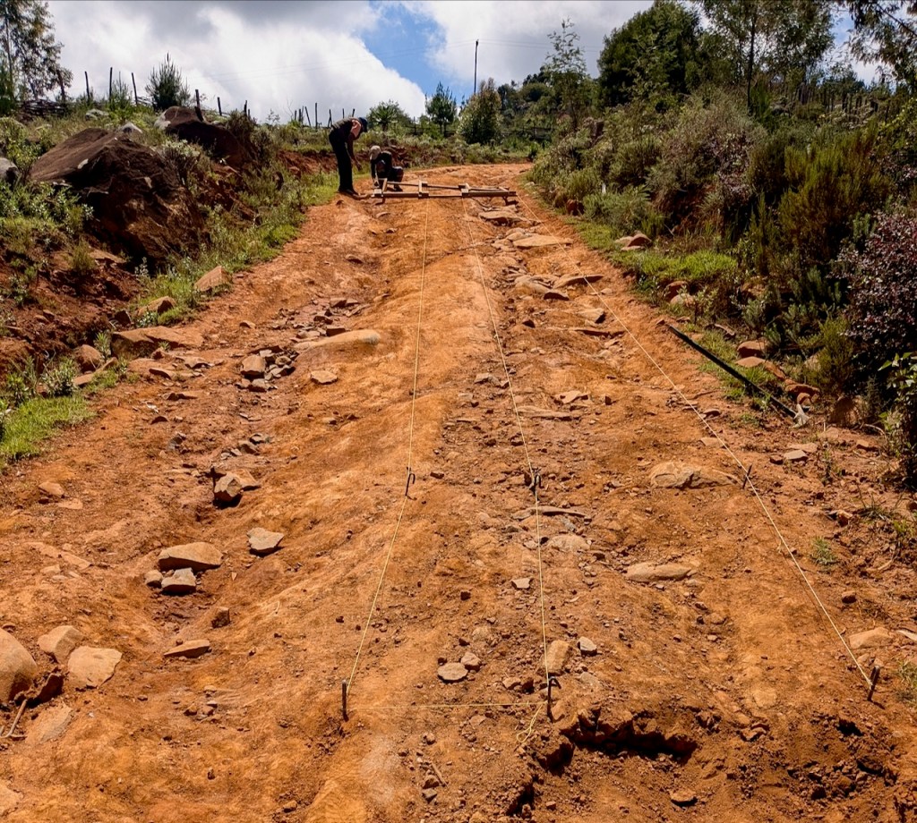
This time we decided to dig out our trenches in advance to improve alignment (height)


Cars need to keep left!
