

It doesn’t have a name that I know of, but it is unmistakable in its presence in Nyanga – this is the escarpment a few hundred metres up to the east where lies Troutbeck / Connemara / World’s View / Bende and continues on northwards further than I know. The same escarpment that is Mount Nyangani to the south.
There is a walking route up / down to Troutbeck through the Bepe Park valley that I haven’t done yet but this is not that walk!
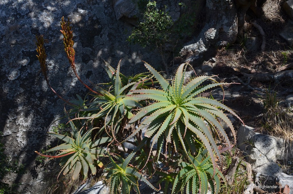
Get to ‘the government’ residential area by turning right off the tar (if you are coming from the south) towards the main police station / hospital then soon turn left where it is signposted to District Administrator’s office. Follow your nose onwards and then to the right, steeply upwards on the rough dust road. I parked below the very visible water tank (Google Maps). The road does continue – actually for kilometres – but this is a walk and the road looked steeper and rougher for a bit, though it does mellow out for a long stretch before becoming really difficult. Yes, it was likely made by those extracting from the land, and there is a bit of ‘forestry’ still ongoing. Much of the area is covered in a strange mix of indigenous msasa type trees and pine on the way up from here. Both have been / are being troubled by humans. I wonder how many years it will take for the pine to outgrow and dominate the msasa?
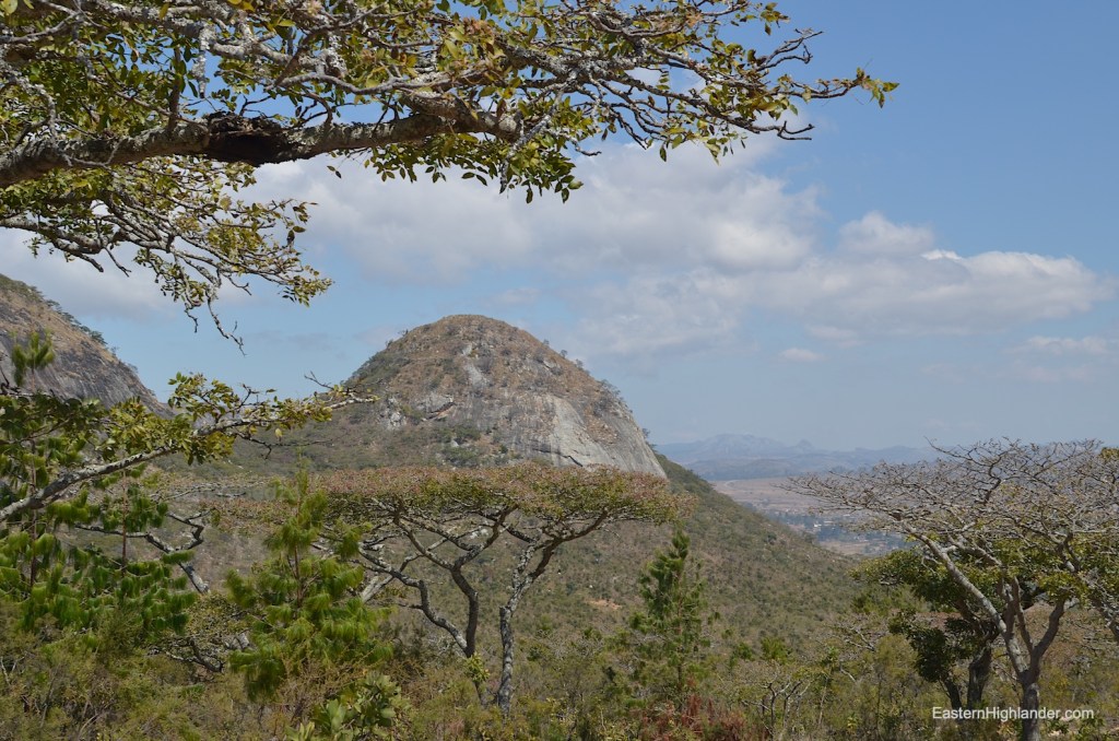
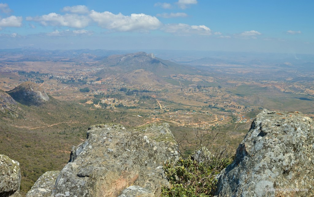
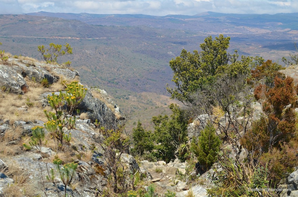
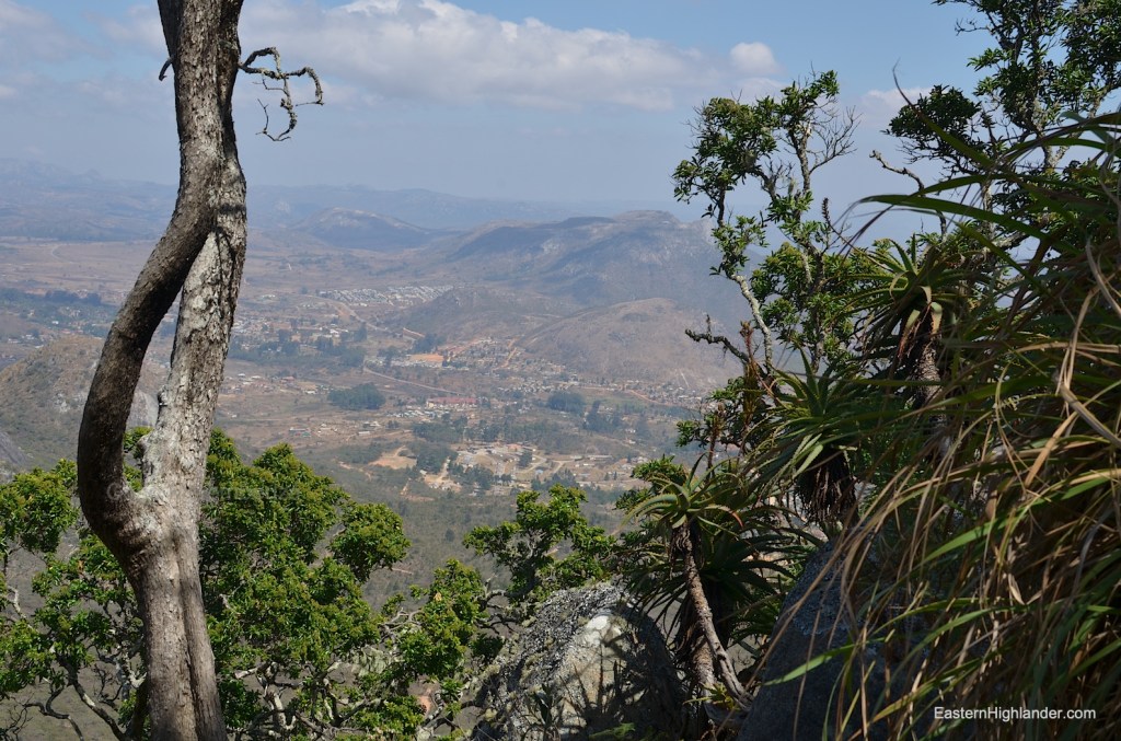
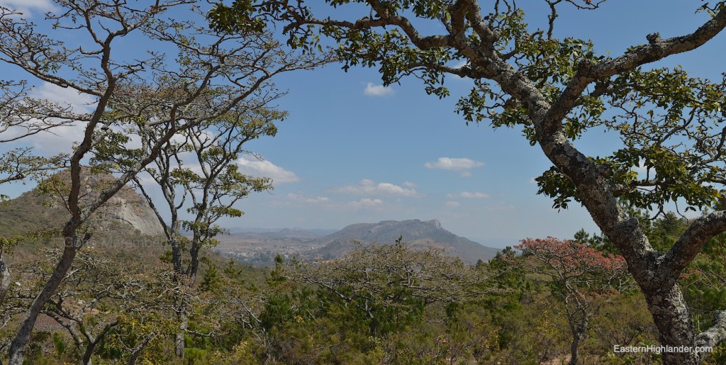
If you happen to meet two gents walking down who nod and say ‘yes’ they are walking down from Connemara it gives you hope for a successful, though intriguing, day ahead. It is a hot walk up following the road/track to the first plateau / logging area (now you know why the dust road was pushed up to here) which makes a great stop for pictures when you scramble south through the low trees for a better view down to Nyanga.

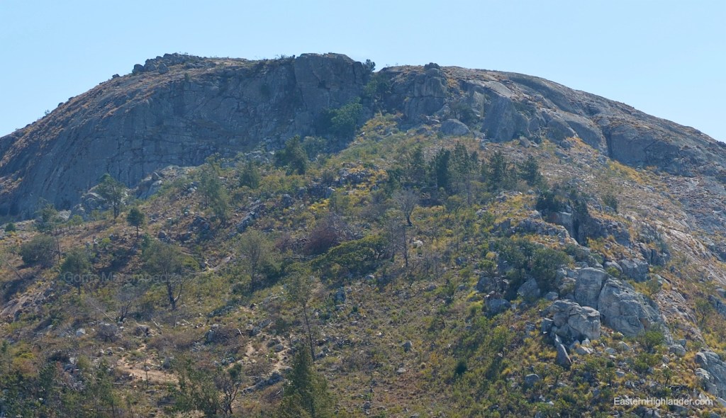
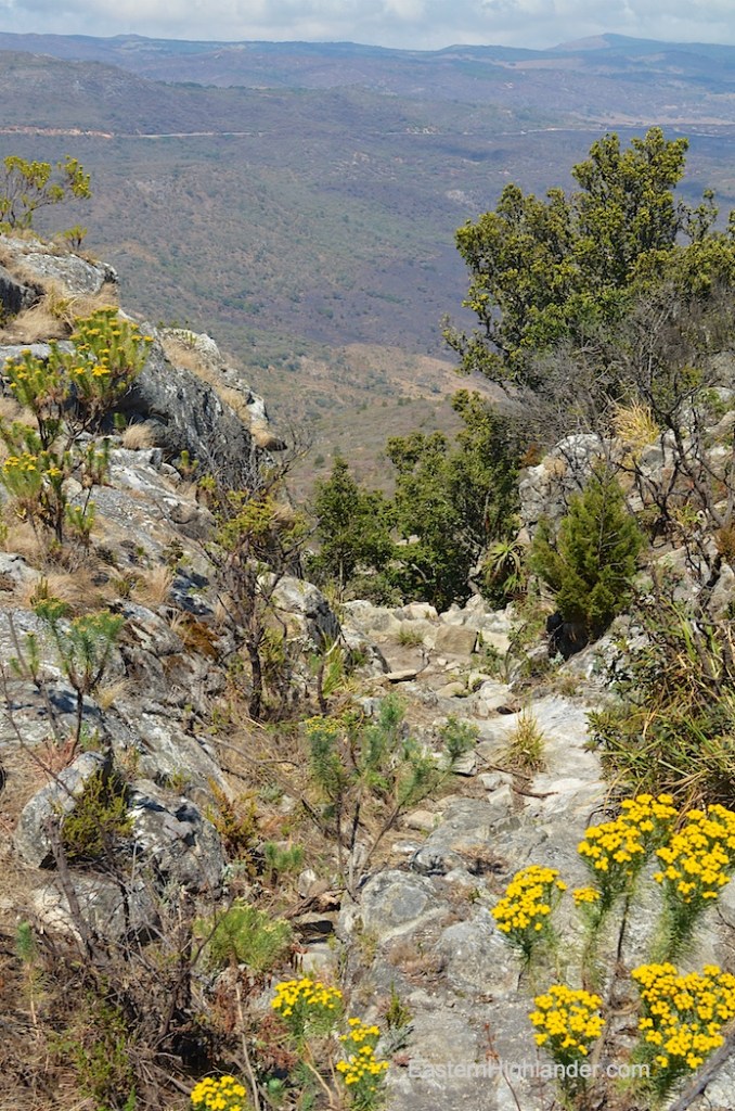
Now the going gets much steeper and you are following the one path up. There are spectacular views and presumably a spectacular drop to the west now. Persevere on up. It is steep, before easing up. Now the alpine wind is reminding you that it is colder when you stop. Ahead and up lies the last and steepest section that is really a scramble up through a 3 metre wide cleft in the rock.
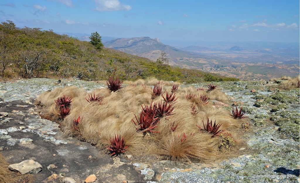
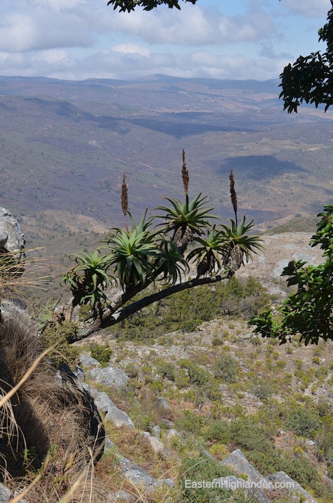
Again it is easier that you would imagine on the way back down so please just push on up! Once though this you have made it. I stopped soon after as it looked like plain walking (famous last words) onwards to the Connemara area. In retrospect there could well be further ‘interesting’ paths to find tracing the lip of the escarpment northwards towards World’s View. From below there is a very characteristic set of rocks further onwards from this point when viewed from Nyanga. After taking more pictures do a 180 and re-trace your path down. The only short cuts were reserved for the lower wooded area where it was possible to cut off long loops in the dust road by following the small but well trodden tracks taken by the professional walkers transiting to / from Connemara.
This is a fine Alpine style walking ascent but you are further away from Nyanga now so the pics feel more hazy and distant compared with the immediacy of the other peaks.
3 hours total plus a bit more if you need a formal rest at the first plateau.


Track data from the Garmin in Google Earth.

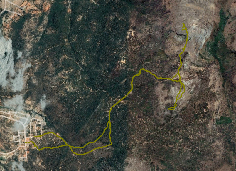
Same track in Garmin Basecamp.

