3 to 4 February 2024
An overnigher down in the Chirwe valley, tributary to the Gairezi (north, north east of Mount Nyangani, towards Dazi) (not named on any modern satellite images – see map, from 1972, at bottom).
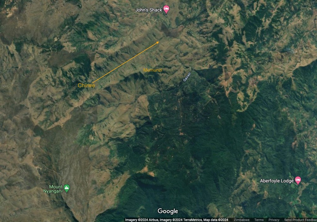
No path down from my direction so I took to Google Earth for inspiration. This is typically not recommended as what looks doable via the nice warm satellite image on the laptop can be entirely different … let’s just say much steeper … in the cold light of ‘I’m stuck here now and any other way out would be much, much longer’.


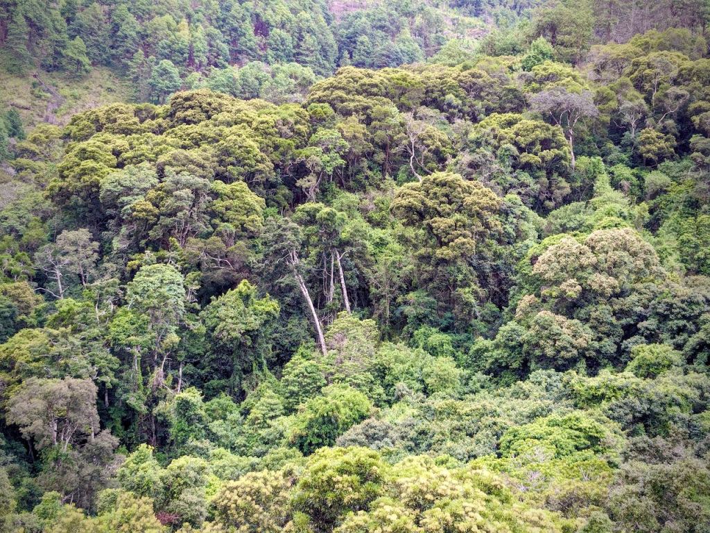
Below my route the woodland was sub-tropical rainforest which still clings on in high, remote, well-watered valleys. Of course it was ‘surrounded’ by invasive pine which the loggers had been to work on – they go wherever they can push a track into for hauling the sawn timber out.

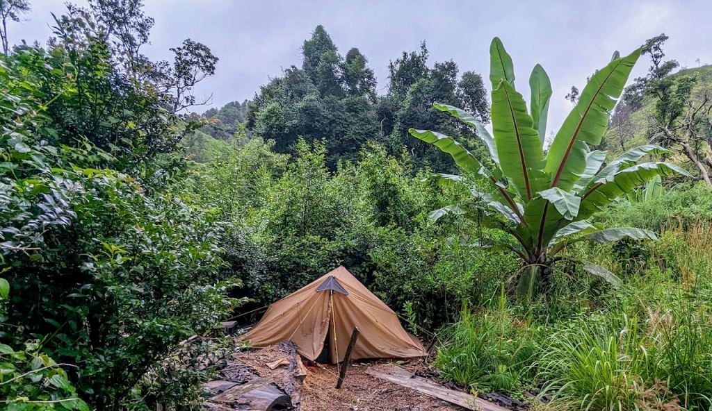
Invasive wild banana
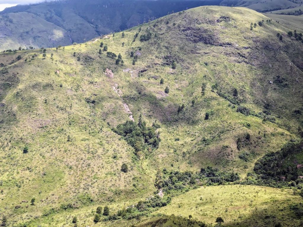
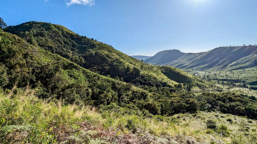
And this is how steep it was in reality for much of the 300m descent:

Down in the valley a very minor tributary was home to 4m tree ferns:

Looking back up from the camp area:

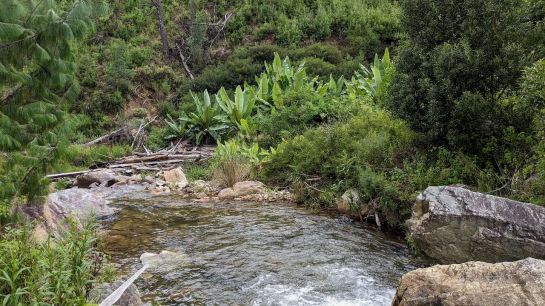
The Chirwe stream / river.
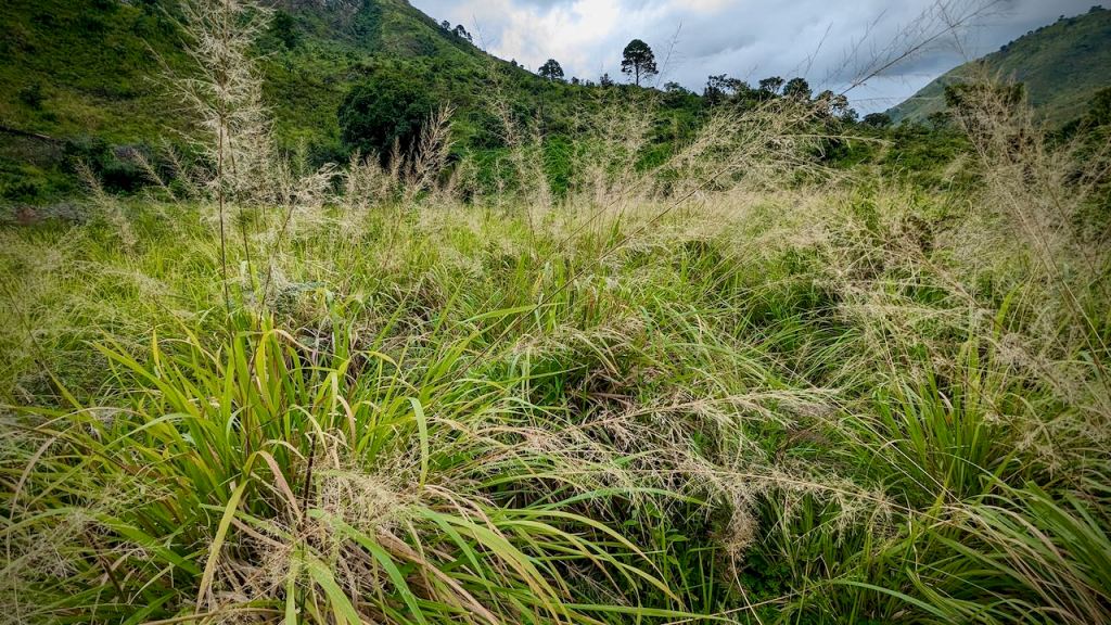
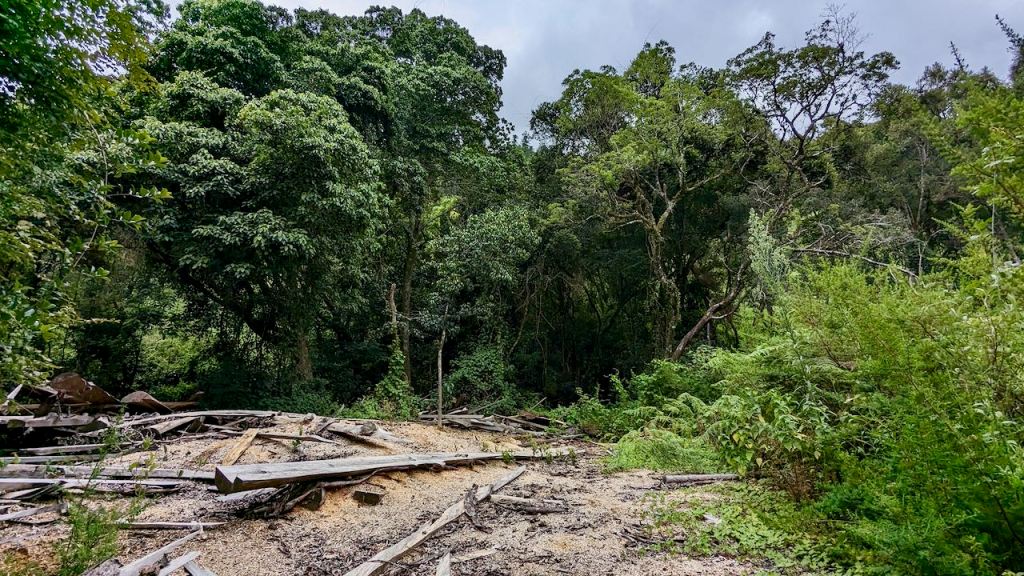
Next, on to why I was camped, poorly, on the sawdust remains of the loggers (who had their own far longer route down to the valley bottom). The land was fertile and wet from the river, hence plenty of bush growing down in the valley. Where there was ‘open’ flattish terrain it was covered in this wonderfully wretched ‘grass’, growing in tall tuff clumps - absolutely no use for campers!
Hence I wandered in and around the areas used by the loggers, crossing the river and back looking for spots:
This next patch was my resting place later on; with more showers imminent, the tent went up in a hurry using improvised off-cut tent pegs for grip.
GOOD MORNING:
Fly-sheet totally soaked and heavier for my walk out! Humidity is well over 50% at the moment and at 1700m it cools overnight so lots of condensation outside and inside. At least it was wet enough to keep the ants safely under the wooden planks with their larvae all night.
This was about 7 am and the sun was still making its way to the valley bottom over the Mumunzi ridge.
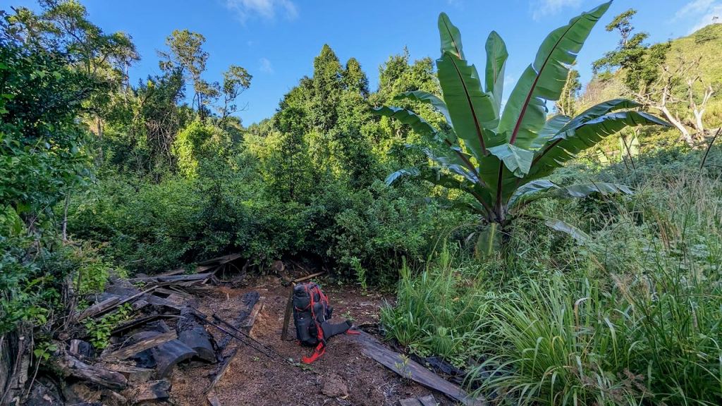
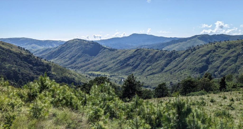
Being curious I started my trip out on the loggers track and got some dramatic views before this headed over to the headwaters on more gentle terrain and probably past more pine trees. Here was yesterday’s route down in the morning light:

Nothing to do but off-piste it up the hill. Slight track made by baboon (or membe (small antelope)) for encouragement – however they don’t know about zigzagging – just going straight up! You can see where I diverged – lower centre where the path starts diagonally upwards to 2200m ! Oh, and did I mention the hand-to-hand baboon scramble up that rocky outcrop at the top. That’s why I don’t think it was for antelope.

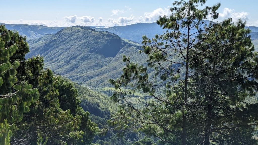
Views out were good though. While still on the logging track – camp circled:


Now climbing more steeply:
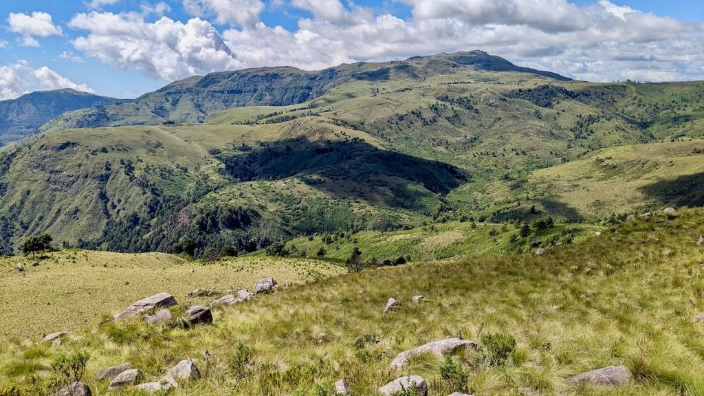
Now really out of the valley and looking squarely at Mount Nyangani:

Not sure I’ll be doing this one again exactly – the climb back out was somewhat nerve wrackingly, exhausting.
However, the mission was not accomplished: there was too much dense bush either side of the Chirwe to cross and find a route up onto the Mumunzi spur. You can see my path along the river-side looking for crossings, and the big dot where I stood under a tree and thought about camping while it rained, making the bush wet, and so me soaking, on the plod back to pitch the tent on the wet sawdust. More Google Earth time needed.


Pingback: 3F UL GEAR Lanshan 2 external mods: increased wind resistance, stronger sides, temporary wilting, and more | Eastern Highlander