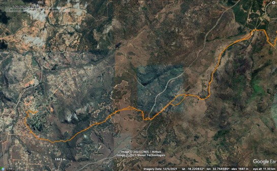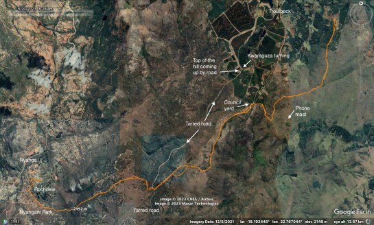
This walk starts in Troutbeck (or, of course, Nyanga) for example at the Council’s Kwaraguza yard / quarry and starts by following the Zesa poles and an old track, which is slowing becoming overgrown with wattle. Part ways with the ZESA line and more or less follow the path of the old track, dodging back and fore to see which side of the broad ridge gives the best views: south east to Nyangani or north west around Nyanga.
I found a trig point and marked it on google maps.
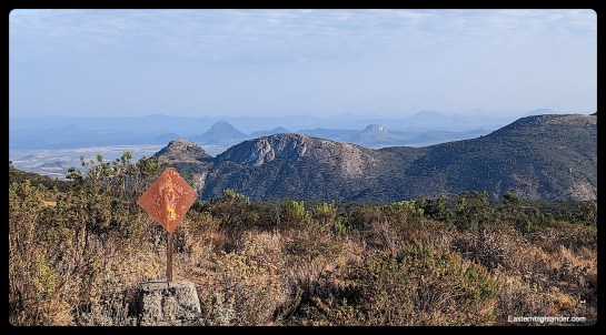
You can skirt the last hill of the ridge to the south side as I did on the way down, or go over the top – on the way back up. There are superb views of the hills and mountains east of Nyanga and onwards to Nyatate.

Finally, this section ends with a very steep descent under the two ZESA lines down to the tarred road. Some holding-on on the way down; it’s easier on the way up! Kind of is and isn’t a path all at the same time; I’m guessing ZESA walk it infrequently – there is the odd new pole.

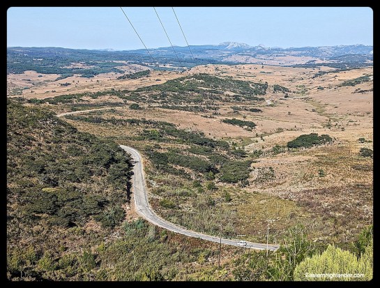
Cross the tarred road and follow the footpath down, detour round and through a shallow gulley then start off on your trip across the open plain.
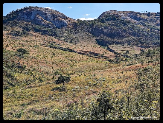
Eventually hook-up with the line of a mainly buried black and blue water pipe and basically follow this all the way (there is a gully on the way which is a cooler place to take a break if it is a hot day) to behind the Bepe hills from where you will find the path down the southern side of the valley and into Nyangani Park.
There is a marshy section of reeds at the bottom, with various pipes crossing it, which could probably be detoured in the wet season. Have some lunch and walk back up!
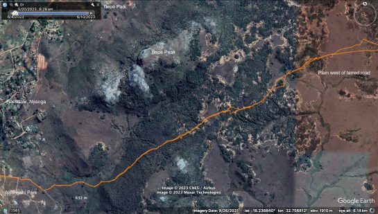

More route maps: